In mid‑July 2025, an unusually slow-moving system drenched New Jersey and New York City with torrential rain, unleashing flash floods, suspended trains, grounded flights, and a statewide state of emergency. This deep‑dive article covers:
- where the flash flood warnings and flooding in New Jersey hit hardest
- the impact on transit and infrastructure—from NYC subways to the NJ Turnpike
- the governor’s response, rescue operations, and continued risks
- how this links to climate change, local preparedness, and resilience plans like NJ’s Pact‑REAL
Multiple National Weather Service alerts went into effect across northern and central New Jersey. Rainfall amounts between 2–5 inches within hours, occasionally peaking at 3–4 inches per hour, overwhelmed drainage systems . A Level 3 flash‑flood risk spanned the I‑95 corridor from Virginia through New Jersey and New York . Forecast models warned of recurrent storms, potentially piling on more rain before any drying trend.
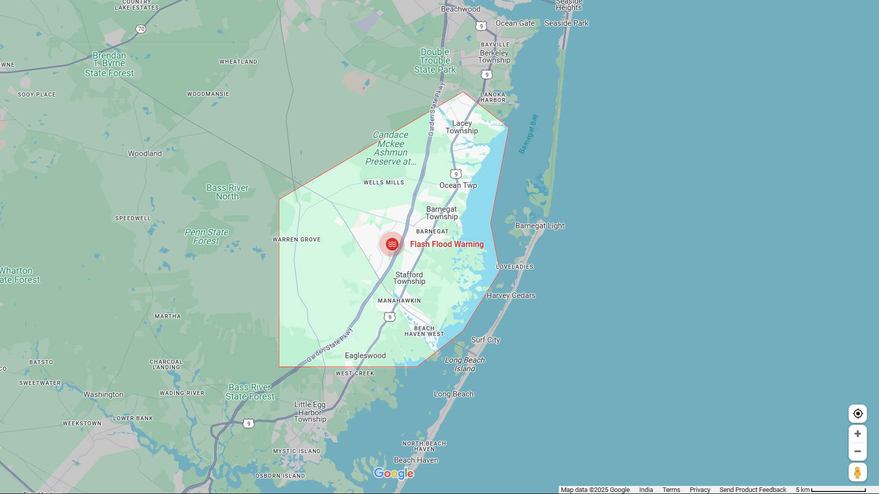
📍 Interactive Flood Zone Map
For a real-time view of impacted areas in New Jersey, explore this interactive map showing flash‐flood zones and road closures: Google Maps – NJ Flood Overlay. This handy visual helps residents identify which neighborhoods are under alert and assess their vulnerability during peak flooding times.
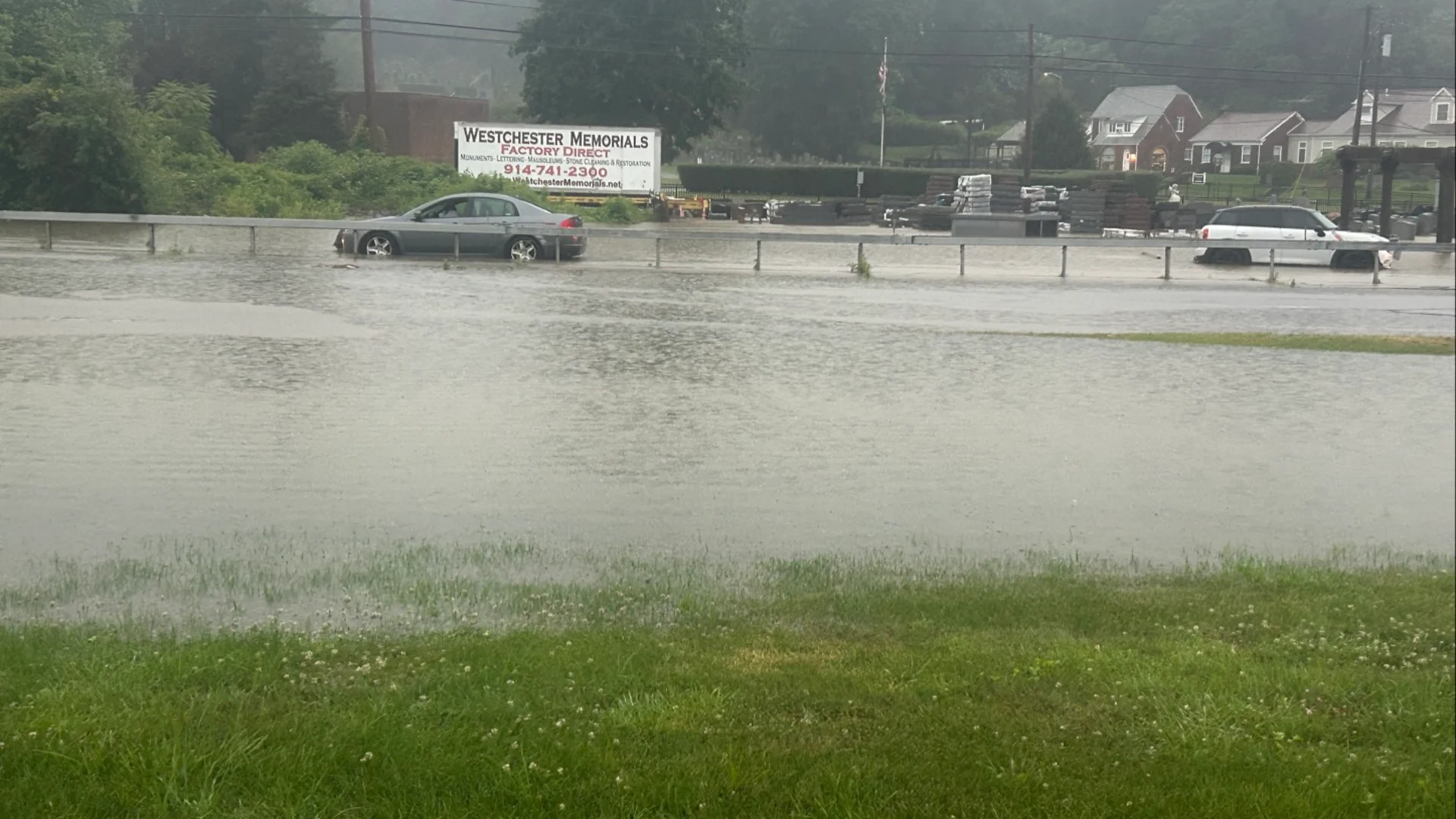
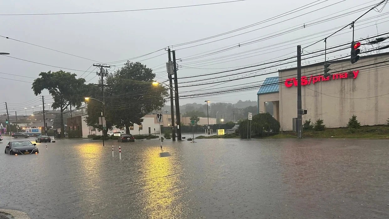
Affected Areas & Rainfall Totals
- Union County (Plainfield, Scotch Plains, North/Central Plainfield): Received 4–7 inches of rain; major roads, including Route 22 and the NJ Turnpike (Exits 12,13A), submerged.
- Ocean, Middlesex, Morris, Somerset, Bergen, Hunterdon, Hudson, Essex, Passaic, Union: Warnings stretched into early Tuesday; towns like Morristown, Metuchen, Somerville, Franklin Park also hit.
- NYC & NYC Subway: All five boroughs under warning; Chelsea saw ~1.47 in/hr, Staten Island ~1.67 in . Videos revealed water flooding platforms and even entering subway cars.
State of Emergency & Official Response
At approximately 7:30 PM EDT on July 14, Governor Phil Murphy declared a State of Emergency across all 21 counties via Executive Order No. 392, urging residents to avoid travel and shelter indoors . He directed people to ready.nj.gov and the National Weather Service pages for updates.
Local alerts notified Plainfield and North Plainfield residents to move to upper floors. Emergency hotlines were overwhelmed with 911 calls, prompting water rescues in urban neighborhoods.
Transit paralysis
New Jersey
- NJ Turnpike closures at Exits 12 & 13A.
- NJ Transit halted the Raritan Valley Line; buses delayed or stranded.
New York
- NYC subway suspended multiple lines; platforms flooded, trains stalled, passengers forced to stand on seats to avoid water.
- Key routes like Cross Bronx Expressway, Saw Mill River Parkway, FDR Drive, Interstate 287 closed due to high water and fallen trees.
Air Travel
- Ground stops ordered at JFK, LaGuardia, Newark Liberty, Philadelphia International, and Reagan National; +11,000 flights delayed or canceled nationwide.
Rescue Efforts & Public Safety
Emergency crews conducted dozens of water rescues for stranded motorists and residents trapped indoors . Some municipalities activated shelter-in-place protocols and evacuated low-lying neighborhoods; Metuchen relocated residents to a high school shelter . Authorities repeatedly urged against driving or walking through floodwaters—warning that just 6 inches can knock a person down, 12 inches can carry away cars.
Causes & Climate Context
Meteorologists attribute the floods to a moist, stationary front slow‑moving over the Northeast, paired with record humidity and temperature. This setup creates extreme rainfall rates (2–4 in/hr) capable of overwhelming urban drainage.
Experts warn that climate change is amplifying such events. Historical comparisons: NYC’s 2.07 inches/hr storm this July was second only to Hurricane Ida’s 3.47 inches/hr . The Weather Prediction Center cautioned: “One storm will follow another…multiple rounds over areas that can’t handle that much rain.”
Infrastructure & Preparedness Challenges
New Jersey’s aging stormwater management and urban drainage systems struggled under heavy downpours. The state’s ASCE Infrastructure Report Card graded stormwater systems a “D” . Similarly, NYC’s combined sewer overflow systems routinely fail under such stress.
Following this event, public scrutiny intensified around the Pact‑REAL flood resilience rules. Originally aimed at adding 5-ft elevation buffers and expanding floodplain maps, the rules faced pushback from business groups due to soaring costs. A revised version adopted a 4-ft buffer and included exemptions for affordable housing, triggering new public comment phases.
What Residents & Authorities Should Do Now
Short‑Term Priorities
- Stay alert during flash flood watches/warnings.
- Avoid floodwaters—even shallow water can sweep people or vehicles away.
- Have a “go‑bag”: phone, flashlight, battery, water.
- Move to upper floors if in flooding zones; heed evacuation orders.
Mid‑to‑Long Term
- Infrastructure upgrades: modernizing stormwater, drainage, and sewer systems.
- Mapping & zoning: use Pact‑REAL flood maps for strategic planning.
- Resilience funding: allocate federal/state funds to reinforce vulnerable infrastructure.
- Public education: increase awareness about flash flood risks and response plans.
The Bigger Picture
This event underscores a troubling climate reality: extreme precipitation events are on the rise. Cities like Newark, Plainfield, Metuchen, and central NJ towns have been recurrently flooded—17 storms caused >$1B in damages in NJ from 2020‑2024 alone, compared to 15 over the previous 40 years . Officials emphasize that only robust, science-based planning, combined with upgraded infrastructure, regulation, and community preparedness, can mitigate future crises.